|
| Heading northeast, Rosedale Beach |
Today we're heading to the other side of the equator to discover places where latitude 35.8167 deg N hits various coastlines. We'll visit the west and east coasts of United States, Morocco, Algeris, Tunisia, Malta, Greece, Syria, China, South Korea and Japan.
Setting off in a northeasterly direction the first place we come to is the rugged coastline of
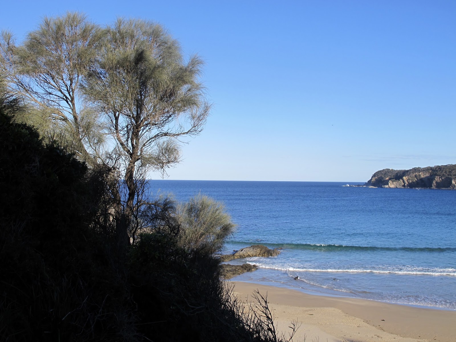
Monterey County, California between Gorda and Ragged Point
The coastline here is rugged, making the waterline inaccessible in places. It is part of a marine and fresh water protection zone.
 |
| http://www.waterboards.ca.gov/water_issues/programs/ocean/docs/asbs/asbs_areas/swqpa20.jpg |
Heading across the United States, we reach the Atlantic coast in North Carolina
North Carolina coast: Alligator River National Wildlife Reserve and Cape Hatteras National Seashore
This area is one of the farthest most northerly homes for alligators. I'm glad there aren't any crocs at Rosedale.
The Alligator River National Wildlife Reserve is between the Alligator River and Croatan Sound. It was established in 1984 to protect and preserve a wetland habitat (the pocasin - bogs, water marshes and swamps) and its associated wildlife species - birds, raptors, American black bear, alligators. It is especially known for the red wolf.
 |
| Above: Cape Hatteras National Seashore: https://www.nags-head.com/images/uploads/place/65/beaches_hero_02.jpg?t=c |
 |
| Cape Hatteras National Seashore https://ssl.c.photoshelter.com/img-get2/I0000bPZxjmSgvsM/fit=1000x750/New-Inlet-Aerial.jpg |
Zooming across the Atlantic, the next landfall is at
Cap Malabata, Mnar, near Tangier in Morocco
Located a short distance east of Tangier, facing the Strait of Gibraltar, it features a lighthouse.
 |
| Cap Malabata near Tangier |
There's only a few places in northern Africa where this latitude hits the coast. Next is in Algeria.
Gdyel, near Oran, Oran Province and near Stidia, Mostaganem Province, Algeria
 |
| Coastline near Oran |
 |
| Beach near Stidia |
 |
| Oran and Stidia |
 |
| Near Oran |
Heading further east, the next port of call is the eastern coast of Tunisia, on the Mediterranean Sea.
Sousse Tunisia
The Medina at Sousse is a UNESCO World Heritage site (http://whc.unesco.org/en/list/498)
For more information about this city: https://en.wikipedia.org/wiki/Sousse
 |
| The Medina at Sousse |
Sadly, on 26 June 2015, an Islamist gunman killed 38 people and wounded 39 on a beach and in the hotel nearby, just north of Sousse. In October 2013 a suicide bomber blew himself up in a botched attempt at an attack at another Sousse beach.
 |
| Lat 35.8167 is just to the left (south) of the port area |
We're sailing off into the Mediterranean, and stopping at:
The Blue Grotto, Malta
Next stop in the Mediterranean is the northern tip of the Greek island Karpathos.
Northern Karpathos, Greece
This is a remote and sparsely populated area, which can be seen on the satellite photo.
The coastline is spectacularly rugged.
 |
| The coastline north of the Agios Ioannis Vrikountas church (see map) |
 |
| Coastline in the area |
 |
| Karpathos |
 |
| Latitude marker and church |
 |
| Satellite picture of area |
Now, to the eastern Mediterranean, and the coast of Syria
Between Al Issawiyah and Ras al Basit, north of Latakia, Syria
A narrow coastal plain stretches south from the Turkish border to Lebanon. It is flat, covered with sand dunes, broken by promontories running down from the mountains to the sea. The population is predominantly Turkmen.
Al Issawiyah is about 15 km south of the Turkish border.
 |
| Northern Syrian coast |
 |
Satellite pic shows the mountains coming down to the coast at the latitude.
|
 |
| Ras Al Bisat and coast |
Latitude 35.8167 N now zooms inland across Iraq, Iran, Turkmenistan, Afghanistan, Pakistan, then hits the coast in Shandong province, China.
Huangdo, near Qingdao, Shandong Province, China
This is the most bizarre site. Remember news reports of green algae covered beaches in China's coastal playground? Well, this is it!
 |
| This is what the beach usually looks like |
Across the Yellow Sea now to South Korea
Near Gunsan on the western side of South Korea
There are plans for the harbour area to be redeveloped with development of reclaimed.
Here's some pretty cool cliffs just to the south - Jeokbyeokgang Cliffs:
Over on the eastern side of South Korea:
Near Gyeongju National Park
The landscape is a little more prosaic on the other side of South Korea where the latitude hits the coast. However, there is a pretty impressive national park a little further south.
Let's move across the Sea of Japan to near
Minamiechizen in Fukui Province, Japan
 |
| Ezichen coast |
The last stop on a land coast before we come full circle back to California is a little east of Tokyo
Hasaki Beach
There is a beach camping ground (and wind farm) along this part of the coast.
 |
| Hasaki Beach |